St Michael’s Old Church
The medieval Church ruin in the cemetery was originally the parish church. The original church was believed to have been built by St Senan around 530AD and it is from this church that the name Kilmihil derives, (Cill Mhichil is Irish for Church of St Michael).
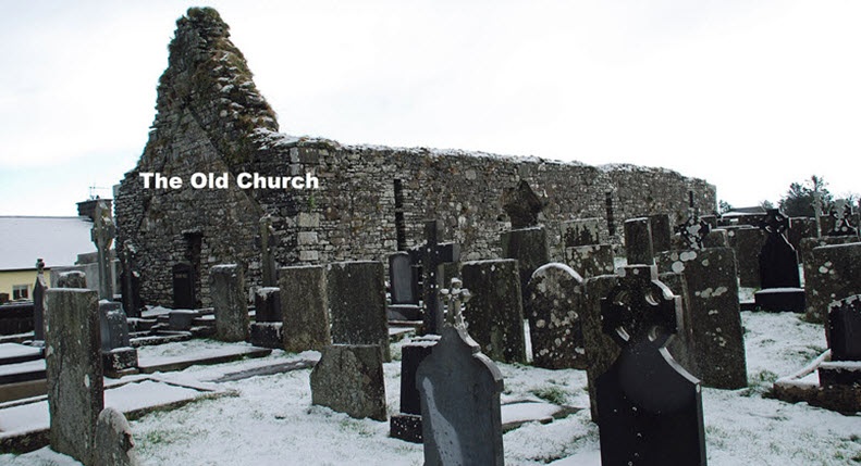
The church ruins were partially rebuilt, cleaned up, cleared and renovated between 1934 and 1937. The cemetery is better maintained than most others in West Clare and contains some fine examples of the house-like tombs peculiar to the area
Cahermurphy Stone Fort

Cahermurphy Stone Fort gave its name, the caher or fort of Murchadha, to the area. Situated in a commanding position at the northern end of the valley on a steep green hill, one of the outposts of the plateau from Mount Callan, it was a stronghold which could resist almost any enemy.
Cahermurphy Bog
In 1946 a two-handled drinking vessel called a Mether found in Cahermurphy bog was donated to the National Museum of Ireland it is described in the records as:
Townland: Cahermurphy Parish: Not given Find: Mether, Wooden
Description: Very well preserved two-handled mether carved out of a single piece of wood, except for the base which was a separate entity. How this was fitted is not evident as there is no rebate for it – probably this object is unfinished. Dimensions: Max Height: 26.8cm, Quadrangular Mouth: 17.2 cm x 15.5 cm
The Mether is now on loan to the Clare Museum where it is on display
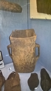
A mether/ meadair is a drinking cup common in Ireland and was used for drinking mead. Most of the vessels found were probably communal cups passed around at celebrations or ceremonies. The Cahermurphy Mether is two handled but four handled methers were also common.
If the design looks familiar that is because the Liam McCarthy trophy was based on the design of an ancient mether.
Part of the Riches of Clare display at the The Clare Museum in Ennis.
Knockmore Lake & Bog
Knockmore Lake and the surrounding bog has been the scene of several interesting archaeological finds. Thomas Haugh of Knockmore discovered an enclosure or pound while cutting turf. The walls were 4 feet long and it may have been designed to hold goats or sheep. In 1980 P.J. Coughlin deepened the outlet from the lake and when the water level dropped by 2 feet he discovered a cooking place close to the enclosure found by Thomas Haugh.
On another occasion Mr Haugh found a type of hurling ball or sliotar, which consisted of a leather cover, stuffed with some type of coarse hair, possibly horsehair, the find was acquired by the National Museum of Ireland in 1971.
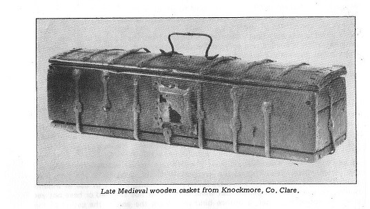
In 1934 a bronze-bound medieval casket was recovered from Knockmore Bog and is now on display in the National Museum registered under acquisition number 1935:432. Image Reproduced from ‘Parish of Kilmihil’ published 1983.
Glenmore Megalithic Tomb
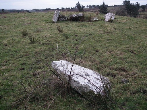
Registered as an ancient monument under the serial number CL039-035—
The Liagauns
Two liagauns or pillar stones stand on a rising ground called Termonroe to the south-west of the church, and possibly marked its lands.
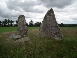
They rise conspicuously against the sky, and are plain uncut monoliths, over 7 feet high, one being 7 feet 4 inches high. Near these is a fort called Kilbride, perhaps commemorating a lost church of St. Bridget, to which they may have belonged.
The defaced ring wall of Cahircanivan lies in the fields behind them to the north-west.
Image courtesy and copyright of Clare Museum.
Knockalough Castle
Courtesy of Paul Markham, excerpt from ‘History of Clonderlaw Castle and its Neighbourhood.
The ruins of Knockalough Castle still remain on the island in Knockalough lake, and on Wednesday evening, September 6th [1989], I had the privilege of seeing the ruin of the Old Castle. Tommy Quinlivan, a local fisherman, provided transport in his rowing boat- a delightful experience.
The island, circular in shape, has a diameter of over 40 metres. The builders chose the south east for the site, and while this Castle does not appear in the 1580 list at Trinity College, it was built by the Mac Mahons of Clonderlaw. The only chieftain mentioned in association with Knockalough Castle was Turlough. He was know as ‘Turlough Roe, the liar and deceiver, who by one stroke killed his wife and child’.

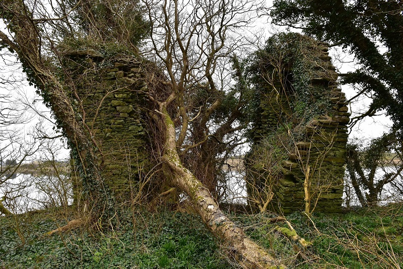
The remains of the Castle today that exist are just two outside walls (east and west). Both are irregular and seem quite dangerous. One remarkable thing, the thickness of the walls measuring about two metres, the western is about 8 metres high while the other is one metre less. On the western side the remains of a fireplace exist, whole on the eastern section a number of square shaped spaces remain clearly to be seen, and this could have been the dividing area of the lower storeys. The building was square in shape with a floor area of eight metres square approximately. Sycamore trees now surround the remains and two of these trees have dominated the interior, while cranes, crows and rats are very much part of the wildlife on the island.
To the north of the Castle ruins, lies a rectangular shaped building now only about two metres in height and it appears at one stage to have had a door and a window facing south. Again, this old ruin could have been the property of the Castle occupiers. The quickest exit to the mainland is just over 100 metres on the roadside direction. During Tommy’s fishing experiences he discovered a shallow area similar to a road, which may have been used by the Castle inhabitants while on horseback going to and from the island.
Some local people claim that this island could have easily been a Crannog dating back to the Bronze Age.
The photographs and video were taken in 2016 and kindly given to us by Martin Murray, which brings the history to life for us. Thank you Martin. More videos of the island can be found on our YouTube channel – Kilmihil Community.
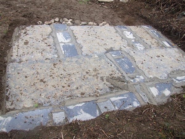
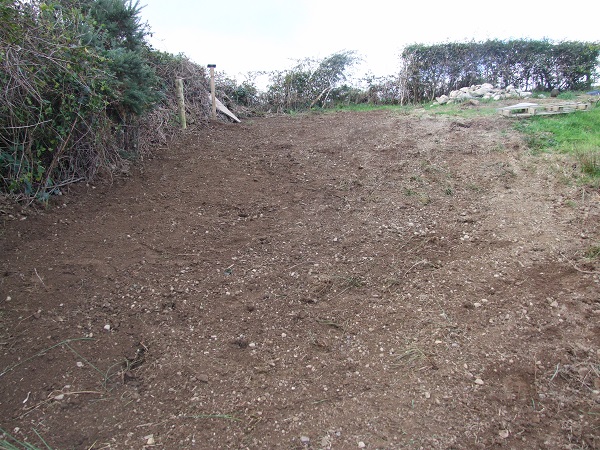
Civil War Bunker Greygrove
There is a Civil War Bunker in the townland of Greygrove. In 2017 Kilmihil Community Development with the help of the CES team cleared the area around the bunker to make it visible and made some necessary repairs. The roof had collapsed some time ago. The images (© Martin Murray) below show the bunker under restoration.

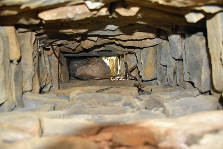
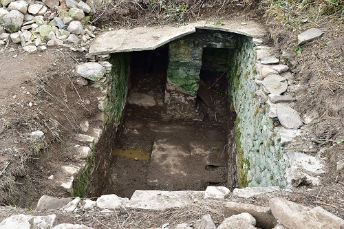

The following photographs where taken by Michael Lineen of the CES after the restoration of the bunker was completed.